Relatives/Heritage items
Displaying 1801 - 1820 of 4694 Relatives
Browsing allows you to see all the records for relatives and heritage items in the GKS. You can also search by material made, and/or filter by nations. To search by material made, type the material's name, by example 'leather', in the box below and click “Apply.” You can select multiple nations from the dropdown list by pressing “Ctrl” (on PC) or “Command” (on Mac) and clicking, then select “Apply.”
Map illustrating the Red and Assiniboyne Rivers; portions of land surrendered in Selkirk Treaty. See IT255 - Western Treaty No. 1, IT256 - "Outside Promises", IT257 - Selkirk Treaty, IT259 - Map (c. 1871), IT260 - Amendments and/or Order in Council, IT261/262 - Amendments (1875).
A memorandum listing a number of items promised to the Chippewa and Swampy Cree Tribes of Indians who surrendered land unto the Crown on the 3 August 1871 (Western Treaty No. 1). See IT255 - Western Treaty No. 1, IT257 - Selkirk Treaty, IT258 -
This painting by George Seton depicts a steamer on the Rideau Canal towing three canoes. It was painted on 20 May, 1862.
Barbed point made of slate with a serrated contracting stem.
Elongated, flat, pointed slate knife or point with straight stem. Collected by Dr. Oronhyatekha; acquired by the ROM in 1911 from the Independent Order of Foresters.
Chippewa surrender to the Crown, of Peach Island, in the Detroit River. Land to be sold for the benefit of the Indians. See IT217 - Manuscript Original or Duplicate & IT218 Copy of Order in Council
This print, by an unknown artist, was published in Cheshire, Connecticut. It is one of the rarest of War of 1812 prints and represents Tecumseh\'s coalition fighting against a US cavalry unit during the War of 1812.
In consideration of an annual payment of 2 pounds 10 shillings, the Mississauga Nation agrees to surrender to the British, a tract of land lying in the Midland and Johnstown Districts. This item is a manuscript duplicate.
See IT085 - Original Surrender
Executive Councils acceptance of the Chippewa Tribe's surrender of land to the Great Western Railway Company of Canada. See IT175 - Original Document & IT177 - Map.
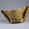
A trough for collecting maple sap made of a sheet of folded birchbark. Collected by F.W. Waugh c. 1890 at Sandfield, Algoma County, north shore of Georgian Bay, Lake Huron
Haudenosaunee wooden club. Ball head gripped by carved talons. Possible motifs include paired feathers, sun, man with feathered headdress and stone axe, woman with club, hunting scene, various animals, cross, whirlpool, and incised lines and chevrons. Dr. Oronhyatekha Ethnology Collection.
The Chippewa and Swampy Cree Tribes of Indians surrender unto Her Majesty Queen Victoria several tracts of land From the International border near Lake of the Woods, north through the southern portion of Lake Winnipeg and southwesterly to the International border. The land is to
This watercolor is George St. Vincent Whitmore, copied from an image by George Heriot. The painting depicts a man seated smoking a pipe/hatchet, on the shore of Lake Charles, Lower Canada. The inscription states that this is a "Domiciliated Indian," which suggests that he is
In consideration of four hundred pounds lawful money, John Steele and Charles George Buller have granted unto Samuel Jarvis Peters a parcel of land located in the Township of Otonabee, containing approximately 400 acres.
A covering letter regarding the return of a document related to the Wyandott surrender of Fighting Island in the Detroit River. See IT244 - Surrender
This is a watercolour painting by Rudolph von Steiger of a deputation from the Mississippi nation to the Governor General of British North America, Sir George Prevost. The painting was done in 1814. It is the companion piece to "Deputation of Indians from the Chippewa
 Knowledge Sharing Platform


