Relatives/Heritage items
Displaying 1721 - 1740 of 4694 Relatives
Browsing allows you to see all the records for relatives and heritage items in the GKS. You can also search by material made, and/or filter by nations. To search by material made, type the material's name, by example 'leather', in the box below and click “Apply.” You can select multiple nations from the dropdown list by pressing “Ctrl” (on PC) or “Command” (on Mac) and clicking, then select “Apply.”
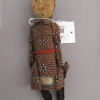
Male doll, probably made by the Huron-Wendat (Huron) community of Wendake (Lorette), originally from the collection of Raphael Bischoffsheim. Doll is made from wood and is hand painted, wearing floral cotton clothes and silver bracelets. It is one of a pair of dolls, with the
Pair of smoked, tanned hide moccasins, elaborated in quill work and ochre, originally from the collection of the Musée de la Marine du Louvre. Possibly Haudenosaunee based on style.
Surrender of 116 acres of land, on the Rama Reserve being the northerly portion of lot 16, 6th concession. To be sold and the interest accruing from the sale monies to be paid annually or semi-annually to the Indians.
This watercolor by John Phillip Bainbrigge is of scene beside the St. Lawrence at Coteau-du-Lac, a lock and canal that was an important site of the defence of the Canadas during the War of 1812 and also a military base during the rebellions of 1837-38
Surrender of land, in trust, to be leased to the benefit of the band and payment to be made from a portion of rents collected "to the individual Indians to whom the respective portions have been or may hereafter be allotted". Approximately 1,500 acres of
Chiefs of the Chippewa Nation cede a tract of land located in the St. Clair River area to the British. Cost of land is 800 pounds Quebec currency.
The Mississaugas located in the Township of Alnwick, in the District of Newcastle agree to surrender to the Crown, a tract of land known as Wahboose Island, containing approximately 600 acres. The Indians desire that the Crown will sell the land and secure the proceeds
French-style metal axehead, manufactured for trade. Collected by Dr. Oronhyatekha; acquired by the ROM in 1911 from the Independent Order of Foresters.
Clarification of procedure regarding the Indians issuing leases on Kettle Island, and a recommendation to set apart a tract of land located on the Ottawa River, for certain Indians.
This water color by Phillip John Bainbrigge is of a camp scene beside the Saint Lawrence, with several canoes being poled up the Saint Lawrence rapids. It was painted c. 1839.
Promotional image of the student staff of the Indian Hall of Fame, CNA, Toronto, 1965.
A view of Rice Lake Indian Village, now Hiawatha First Nation, \"in the Chinese style\" made on September 7, 1860 by Henry Wentworth Acland, who accompanied the Prince of Wales on the first royal tour of Canada.
A Provisional surrender of 67 and 1/2 acres of land by the Chippewa Indians of the River Thames, to be set apart as a parsonage and school lot at Lower Munsee, of which, both buildings are to be connected to Rev. Richard Hood, missionary for
A tract of land in the Township of Smith, in the County of Northumberland, in the District of Newcastle, containing 1,600 acres is being granted to the Company for the Propagation of the Gospel in New England by the Crown. Reserving land for a road
A surrender of four acres of lands located in Caradoc Township by the Chippewas Indians in order that it be granted in fee simple or otherwise for the Episcopalian Church and burying ground.
Map indicating location of the lands set aside as reserves for the Metis. Two reserves emcompassing 160 acres and 17-1/2 square miles respectively, located at the mouth of Rainy River at Rainy Lake. See IT266 - Western Treaty No. 3, IT267 - correspondence, IT268/269/270 -
Surrender of Nawash reserve and three lots in the Caughnawaga tract to be sold to the Crown for the benefit of the Nawash Indians including the Caughnawaga families. All the Indians will remove to Cape Crocker.
This lithograph based on a sketch by John Richard Coke Smyth depicts a hunting scene with a Huron-Wendat hunter.It dates from 1840.
An Order in Council recommending that two deeds of surrender by the Chippewa's of St. Clair, yielding up two islands to the Crown, should be approved. See IT 216/217 - Surrender and Copy & IT219/220 - Surrender
 Knowledge Sharing Platform


