Relatives/Heritage items
Displaying 1421 - 1440 of 4694 Relatives
Browsing allows you to see all the records for relatives and heritage items in the GKS. You can also search by material made, and/or filter by nations. To search by material made, type the material's name, by example 'leather', in the box below and click “Apply.” You can select multiple nations from the dropdown list by pressing “Ctrl” (on PC) or “Command” (on Mac) and clicking, then select “Apply.”
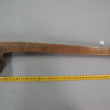
A wooden ball-headed club attributed to the Menomini with engravings, made before 1846.
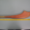
A wooden ball-headed club from the Eastern Great Lakes region with engravings, made before 1846.
Copy of a surrender of 3,450 acres of land at the head of Lake Ontario in Nelson Township Halton County;
including soil, woods, water and title upon receipt of 75 pounds 2 shillings 6 pence of Quebec currency in value of goods. See IT029 -
Copy of map illustrating land surrendered to the Crown by the Chippewa Nation lying on or near the River Chenail and Carte in the Lambton and Kent Counties. See IT025 - Original, IT026 - Map of Surrender, Surrender, IT027 - Duplicate Surrender
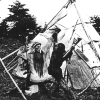
Two actors in the Hiawatha pageant appear to be dualing outside a birchbark teepee, both wearing Plains style fringed buckskin and feathered headdresses.
Copy of map illustrating Chippewa surrender of land located on the north shore of the River Thames. See IT021 - Original Surrender, IT022 - Original Map, IT023 - Duplicate Surrender
Map illustrating land surrendered to the Crown by the Chippewa Nation lying on or near the River Chenail and Carte in the Lambton and Kent Counties. See IT025 - Original Surrender, IT027 - Duplicate Surrender, IT028 - Duplicate Map
Copy of surrender in which the Chiefs of the Chippewa Nation ceded a tract of land located in the St. Clair River area to the British. Cost of land is 800 pounds Quebec currency. See IT025 - Original surrender, IT026 - Original Map, IT028 -
Map to illustrate land purchased by the Crown from the Chippewa Indians of the River Thames. See IT021 - Original Surrender, IT023 - Duplicate Surrender, IT024 - Duplicate Map
Copy of a surrender of land by the Chippewa Nation on the north shore of the River Thames upon the receipt of 1200 pounds currency value in goods. See IT021 - Original Surrender, IT022 - Original Map, IT024 - Duplicate Map
An agreement by the Chippewa Nation to surrender unto the Crown, a tract of land located in Penetanguishene upon the receipt of 100 pounds currency worth of goods to be paid to the Indians. See IT017 - Original Surrender Agreement, IT018 - Map, IT019 -
An agreement by the Chippewa Nation to surrender unto the Crown, a tract of land located in Penetanguishene upon the receipt of 100 pounds currency worth of goods to be paid to the Indians. See IT017 - Original Surrender Agreement, IT018 - Map, IT020 -
Sketch to illustrate land purchased from the Chippewa Indians at Penetanguishene. See IT017 - Surrender & IT019 - Provisional Surrender & IT020 - Copy of Provisional Surrender
Mississauga surrender of 3450 acres of land to the Crown in consideration of 100 pounds lawful money. Lands located on Burlington Bay north of Lake Ontario.
A government grant of land fronting on the Bay of Quinte forming Tyendinaga Township in compensation for war losses and as a show of appreciation to the Six Nations.
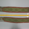
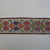
Anishinaabe loom woven beaded bandolier strap or belt attributed to John Tecumseh Henry. Has two distinct design motifs of equal armed crosses, stylized floral elements and crayfish design. Made of size 10 translucent and opaque beads, woolen tape and canvas lining. Dr. Oronhyatekha Ethnology collection.
 Knowledge Sharing Platform

