Map of Indian Burial Ground, 5 August 1816
Map of Indian Burial Ground, 5 August 1816
Map of Indian Burial Ground, 5 August 1816


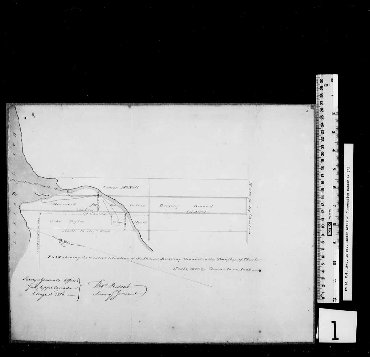
A map indicating the location of an Indian burial ground located in the Township of Thurlow. See IT051 - Lease Agreement, IT053 - Surrender, IT054 - Lease, Map, and Surrender
Mississauga burial ground
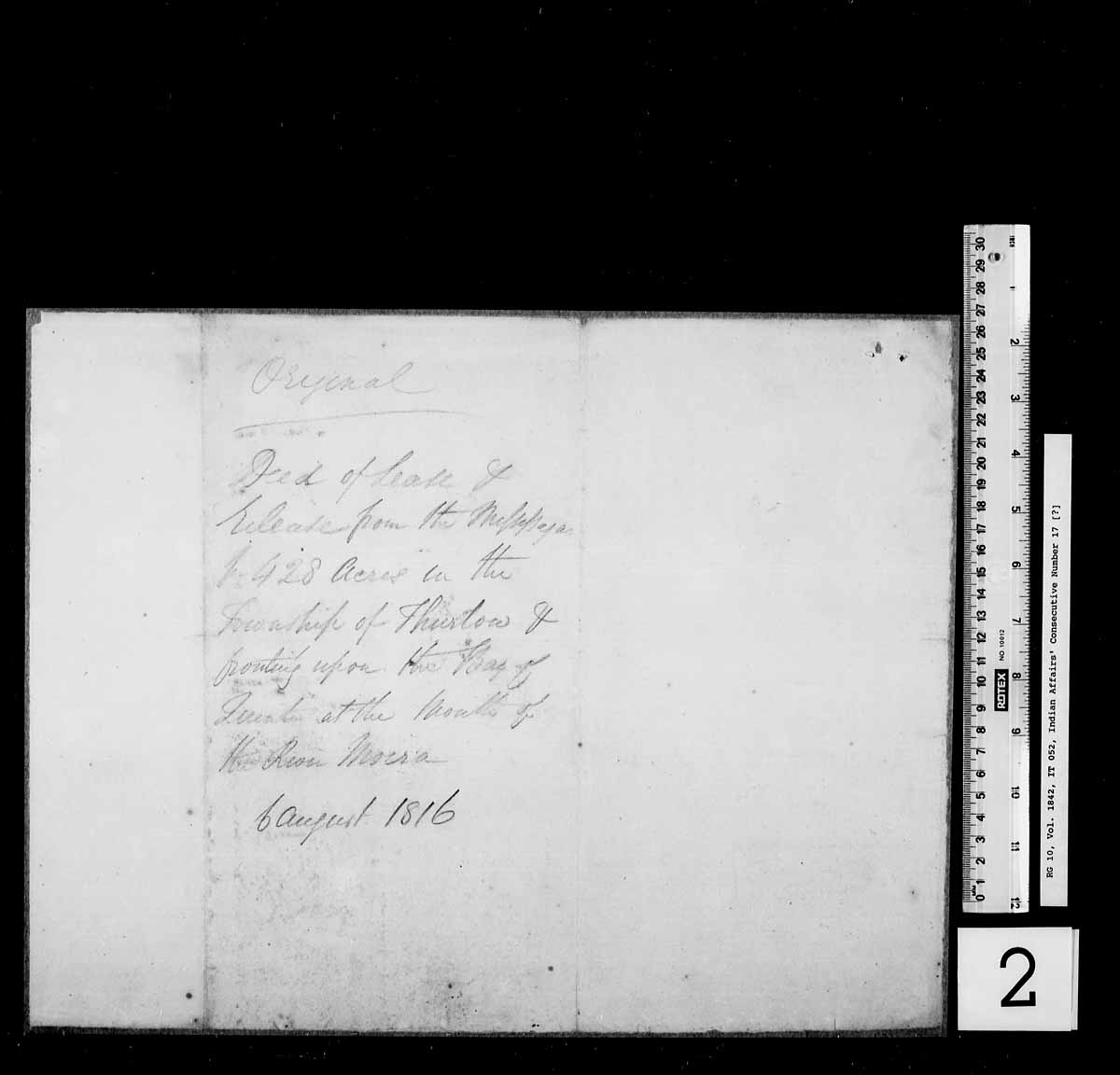
Treaty document
Read More About This Relative
parchment; yellow, blue and brown colouring, ink
Description of Land:
A map to indicate the location of an Indian burying ground in the Township of Thurlow. The land fronts the Bay of Quinte near the mouth the Moira River. This land was part of a treaty agreement between the Mississaugas and the Crown dated 5 August 1816.
coloured yellow for reserve, blue for water, brown for pathways
Date document signed
Provenance
About This GRASAC Record
5 August 1816, Map of Indian Burial Ground, Library and Archives Canada, Indian Affairs, D-10a, Series A, Volume 1842, Reel T-9938, GAD REF IT052, https://gks.grasac.org/ (GKS ID: 1591, accessed [date]).
This record was created under the direction of Heidi Bohaker as part of a larger research project funded by an Aboriginal Research Grant titled “Braiding Knowledges: Anishinaabe Heritage in Community Perspective” from the Social Sciences and Humanities Research Council (SSHRC).
43.3, -78.1
Location of burial ground