Lease Agreement, Map and Surrender for Land in Thurlow Township, 5-6 August 1816
Lease Agreement, Map and Surrender for Land in Thurlow Township, 5-6 August 1816
Lease Agreement, Map and Surrender for Land in Thurlow Township, 5-6 August 1816
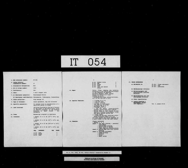
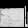

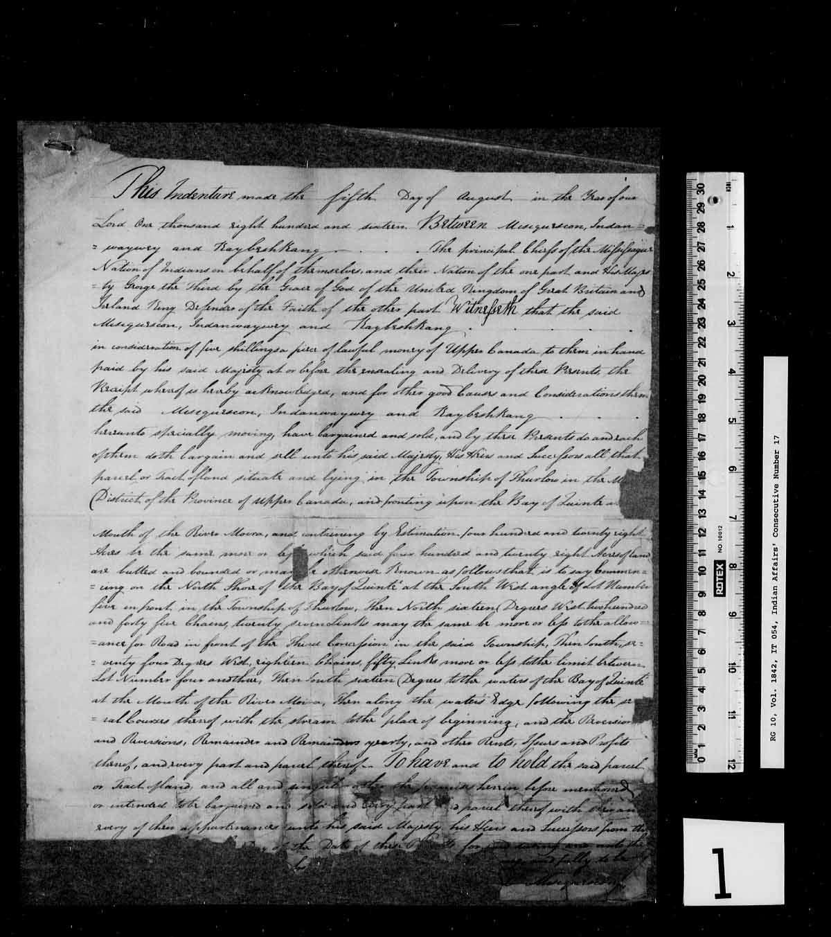

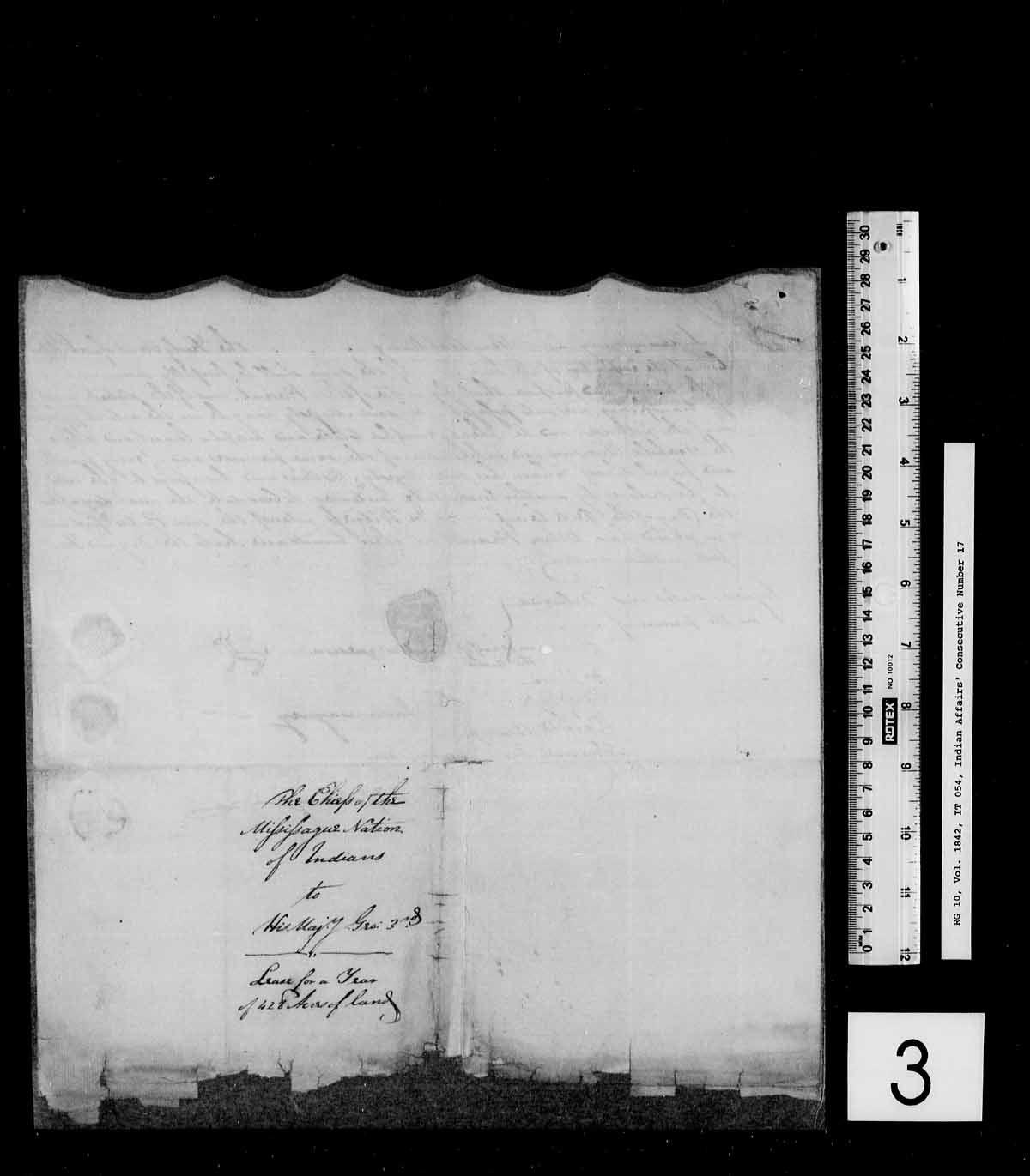
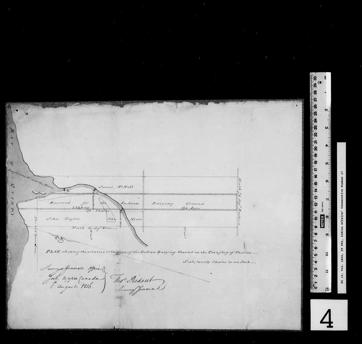
A lease agreement, map, and surrender to release land in consideration of a sum of money. The Mississauga Nation agreed to surrender unto the Crown 428 acres fronting on the Bay of Quinte at the mouth of the Moira River lying in Thurlow township, in the Midland District of Upper Canada. See IT051 - Lease Agreement, IT052 - Map, IT053 - Surrender.
First Nation surrendering lands to the Crown
English: Summer
Treaty document
Read More About This Relative
parchment, ink, pink ribbon, wax; blue, yellow, brown colouring
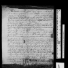
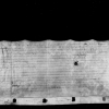
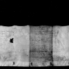
3 doodemag on page 3, and 1 red wax seal; 3 doodemag on page 7, and 3 red wax seals
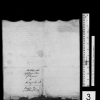
Description of Lease Agreement:
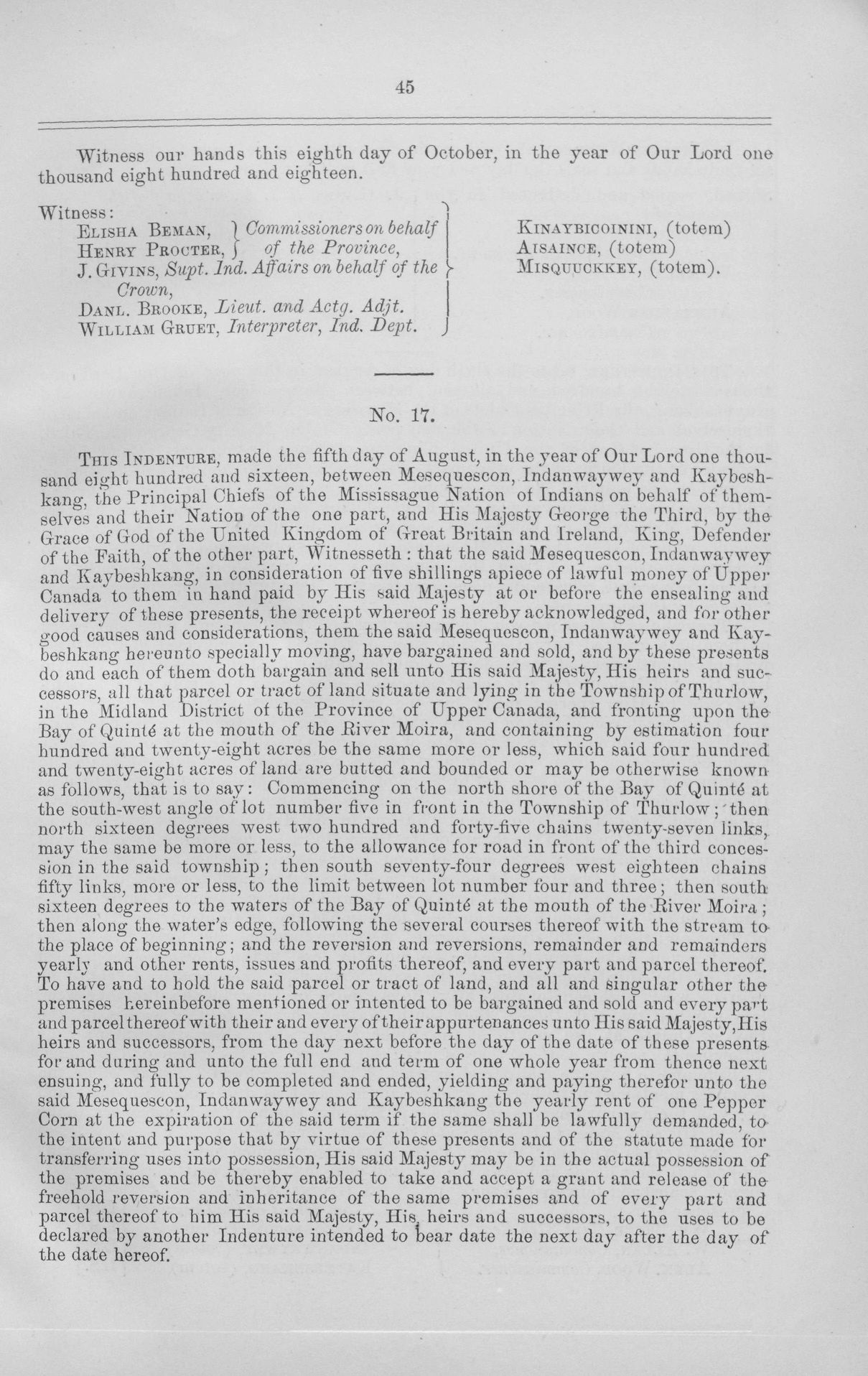
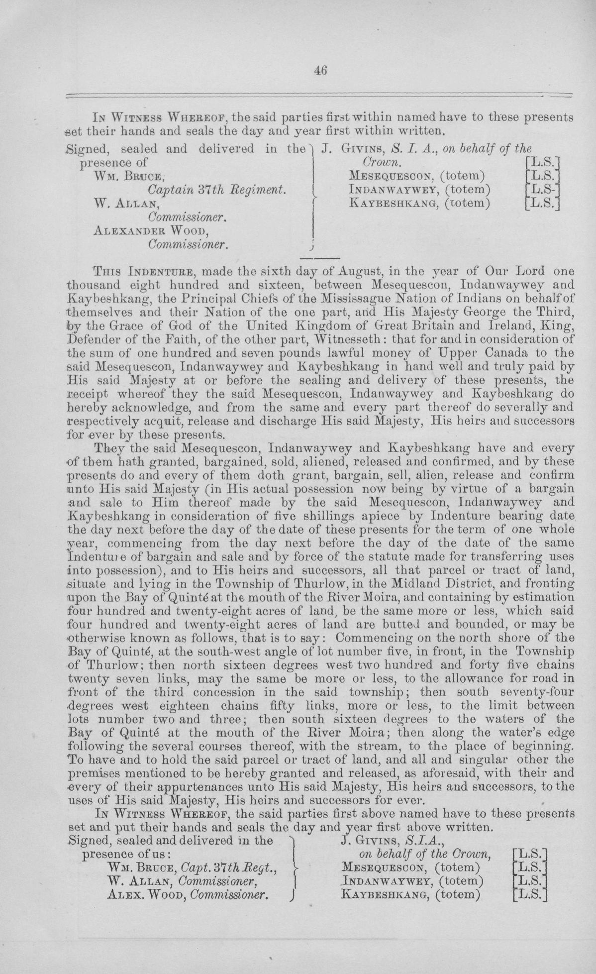
Tract surrendered for lease contains 428 acres of land in the Township of Thurlow, in the Midland District of the Province of Upper Canada, and fronts the Bay of Quinte at the mouth of the River Moira. Commencing on the north shore of the Bay of Quinte at the south-west angle of lot number five in front in the Township of Thurlow; then north sixteen degrees west two hundred and forty-five chains twenty-seven links, may the same be more or less, to the allowance for road in front of the third concession in the said township; then south seventy-four degrees west eighteen chains fifty links to the limit between lot number four and three; then south sixteen degrees to the waters of the Bay of Quinte at the mouth of the River Moira; then along the waters edge, following the several courses thereof, with the stream, to the place of beginning. Leased for five shillings a piece lawful money.
Witnesses:
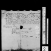
Wm. Bruce, Captain 37th Regiment
W. Allan, Commissioner
Alexander Wood, Commissioner
Crown Signatories:
J. Givins, S.I.A., on behalf of the Crown
First Nations Signatories:
Mesequescon
Indanwaywey
Kaybeshkang
Description of Surrendered Land:
Tract surrendered contains 428 acres of land in the Township of Thurlow, in the Midland District of the Province of Upper Canada, and fronts the Bay of Quinte at the mouth of the River Moira. Commencing on the north shore of the Bay of Quinte at the south-west angle of lot number five in front in the Township of Thurlow; then north sixteen degrees west two hundred and forty-five chains twenty-seven links, may the same be more or less, to the allowance for road in front of the third concession in the said township; then south seventy-four degrees west eighteen chains fifty links to the limit between lot number four and three; then south sixteen degrees to the waters of the Bay of Quinte at the mouth of the River Moira; then along the waters edge, following the several courses thereof, with the stream, to the place of beginning. Purchase price of surrendered land is 107 pounds currency.
Witnesses:
Wm. Bruce, Captain 37th Regiment
W. Allan, Commissioner
Alexander Wood, Commissioner
Crown Signatories:
J. Givins, S.I.A., on behalf of the Crown
First Nations Signatories:
Mesequescon
Indanwaywey
Kaybeshkang
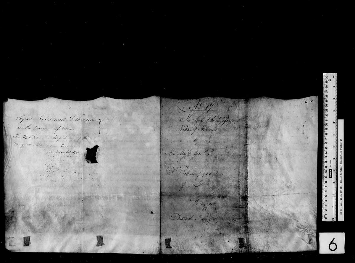
Sheet 2: bottom edge torn, pieces missing
Sheet 4: yellowed, ink faded, brittle, dirty, small holes
Date documents signed
Provenance
Canada, Indian Treaties and Surrenders from 1680 to 1890, 2 vols., (Ottawa: Queen’s Printer, 1891), 1: 45-46.
About This GRASAC Record
5&6 August 1816, Lease Agreement Map and Surrender for Land in Thurlow Township, Library and Archives Canada, Indian Affairs, D-10a, Series A, Volume 1842, Reel T-9938, GAD REF IT054, https://gks.grasac.org/ (GKS ID: 1595, accessed [date]).
This record was created under the direction of Heidi Bohaker as part of a larger research project funded by an Aboriginal Research Grant titled “Braiding Knowledges: Anishinaabe Heritage in Community Perspective” from the Social Sciences and Humanities Research Council (SSHRC).


Location where document signed