Map of Toronto Purchase, 1 August 1805
Map of Toronto Purchase, 1 August 1805
Map of Toronto Purchase, 1 August 1805


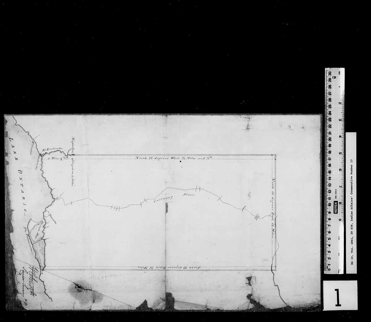
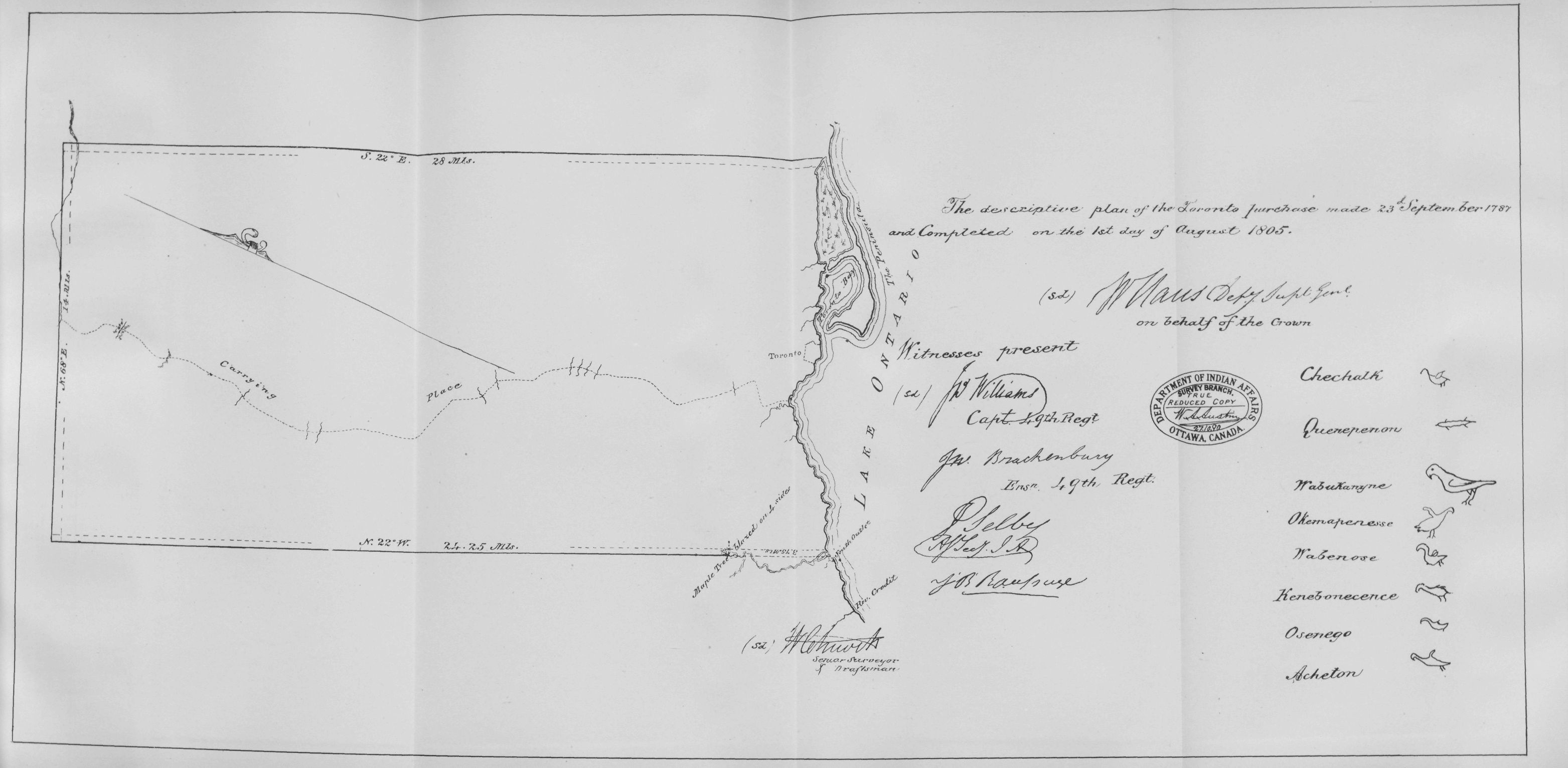
Map illustrating the Mississauga surrender of 250,880 acres of land located north of Lake Ontario and east of the Etobicoke River. Known as the Toronto Purchase. See IT038 - Surrender, IT040 - Surrender Copy
First Nation surrendering lands
Treaty document
Read More About This Relative
parchment, pink and blue ink
8 doodemag
Description of Land Sold (from IT038):
The people of the Mississauga Nation have agreed to sell unto the English King a tract of land commencing on the east bank of of the south outlet of the River Etobicoke; thence up the same, following the several windings and turnings of the said river to a maple tree blazed on all four sides at the distance of three miles and three quarters, in a straight line from the mouth of the said river; thence north twenty-two degrees west twenty-four miles and one-quarter; then north sixty-eight degrees east fourteen miles; then south twenty-two degrees east twenty-eight miles, more or less, to Lake Ontario; then westerly along the water’s edge of Lake Ontario to the eastern bank of the south outlet of the River Etobicoke being the place of beginning. All together the land mentioned includes 250,880 acres.
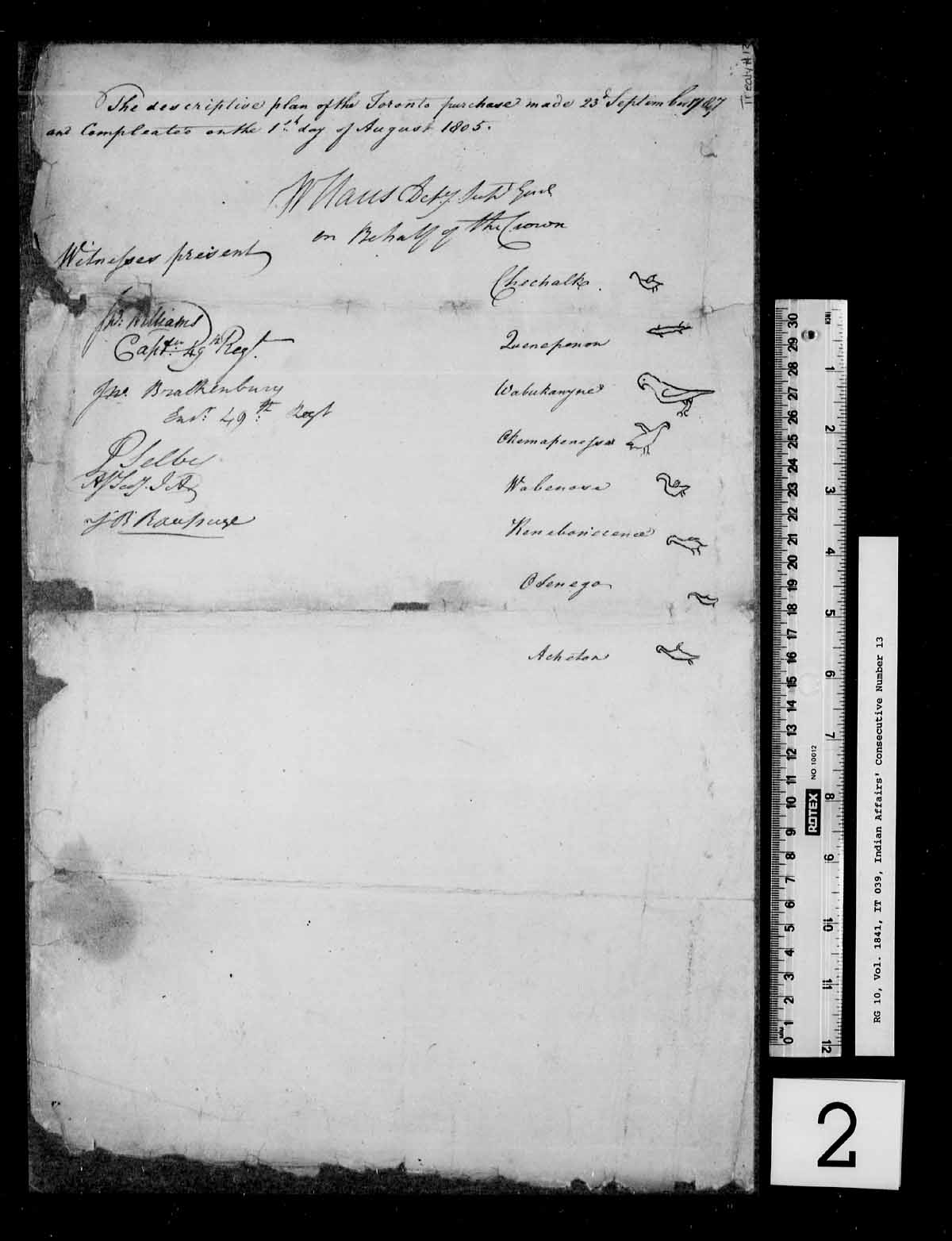
Witnesses:
J.W. Williams, Capt. 49th Regt.
Jno. Blackenbury, Ens. 49th Regt.
P. Selby, Asst. Secy. I.A.
J.B. Rousseaux
Crown Signatories:
Wm. Claus, Deputy Superintendent General, on behalf of the Crown.
First Nation’s Signatories:
Chechalk
Quenepenon
Wabukanyne
Okemapenesse
Wabenose
Kebonecence
Osenego
Acheton
Date document signed
Provenance
Canada, Indian Treaties and Surrenders from 1680 to 1890, 2 vols., (Ottawa: Queen’s Printer, 1891), 1: 34-35.
About This GRASAC Record
1 August 1805, Map of Toronto Purchase, Library and Archives Canada, Indian Affairs, D-10a, Series A, Volume 1841, Reel T-9938, GAD REF IT039, https://gks.grasac.org/ (GKS ID: 1554, accessed [date]).
This record was created under the direction of Heidi Bohaker as part of a larger research project funded by an Aboriginal Research Grant titled “Braiding Knowledges: Anishinaabe Heritage in Community Perspective” from the Social Sciences and Humanities Research Council (SSHRC).
44.04879, -77.58013
Location of treaty lands